Kip Daugirdas’s video “56 Miles (90 km) Above Earth – Successful Amateur Rocket Launch” shows the curve of the horizon. This is visible when the horizon is on either side of the center of the frame. The camera is a GoPro with a rectilinear lens.
The horizon’s curve is easily visible no matter where the horizon is in relation to the center of the frame. Here is a link queued up to the horizon above center of frame: https://youtu.be/4QsEPEhq5yk?t=501
Here is a link queued up to the horizon below the center of frame: https://youtu.be/4QsEPEhq5yk?t=494
Two-stage amateur rocket flight to 293,488 ft (55.6 mi/89.5 km). This rocket is called MESOS (short for mesosphere) because it is designed to fly there. The mesosphere is the third layer of Earth's atmosphere situated between 31 and 53 miles (50-85 km) above the surface. The amazing part about this rocket is it reached this altitude on less than 41,000 N-s of total impulse (full O-class high power rocket motor)! Capable of carrying the equivalent of a 16 oz can of beer/energy drink as a payload, this rocket flew two GoPro Hero 9s with modified rectilinear lenses. Both stages are recovered via parachutes and are reusable. This video covers the development and the launch of this record breaking rocket. I hope you enjoy it!
|
Seeing/Curvature
The earth is big so can appear flat Curvature studies Forward - Back vs Side to Side Seeing from a higher vantage point Theodolite and the Dip of the Horizon Pilots things coming into view flat-horizon - And we can sometimes see a very clear horizon if the distance to the horizon is well within our visibility range. If the Earth is flat, we would never be able to see a clear horizon, and the horizon will always be blurry. Explains superior mirage Explains why things do not vanish smaller and smaller Flerspective - Invented explanation of why bottom part is clipped. Perspective of a city vanishing point Refraction effects and Snells Law (Unrealistic angles) Atmospheric Refraction and the Position of the Sun in the Flat-Earth Model (.57%) Superior and Inferior Mirages |
Water Level Demonstrates The Dip of the Horizon and Proves Earth’s Curvature
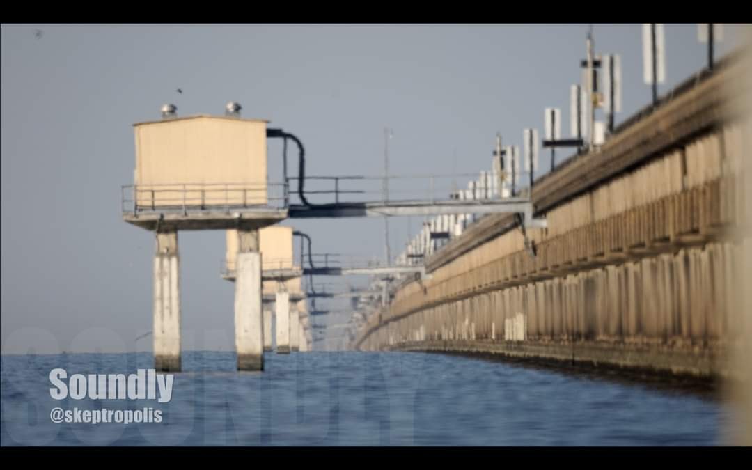
Horizon - Hull Up and Hull Down Crow’s Nest on Ships (Toronto Case Study) Evidence of Curvature: Turning Torso Building, Malmö, Sweden Atchafalaya Basin Observations: Curved Water Found Bedford Level Experiment Confirmed the Curvature of the Earth Thorntonbank Wind Farm (near the Belgian coast) kansas pancake Salt flats Qibla direction proves earth is a sphere Suez Canal - Level is Equipotential not flat Nile River Suspension Bridges Curvature (Humber Bridge) Railroad tracks Curvature Leveling and Surverying |
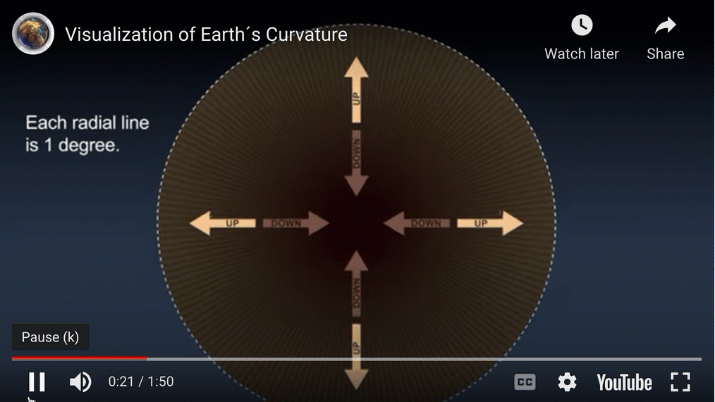
Most people (especially flat earthers), do not seem to understand how BIG the earth is, which is why it is hard to see the curvature side to side across the horizon even on a commercial jet (but it is there).
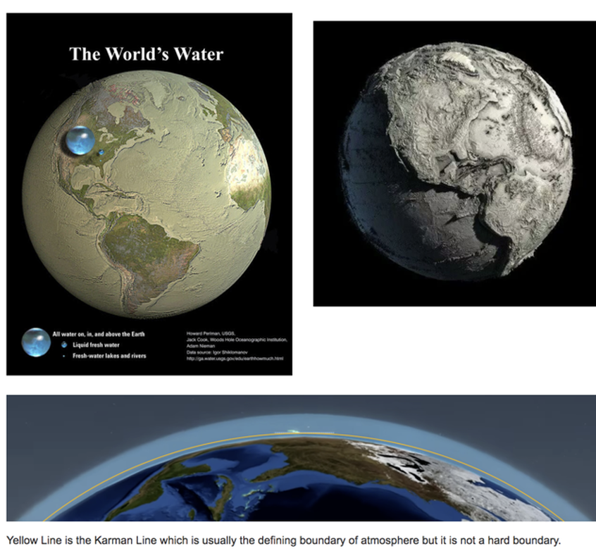
To get a sense for the immensity in size, consider that from the deep point in the Mariana Trench to the top of Mount Everest is a total of 12.5 miles (Mariana is 7 miles deep, and Everest is 5.5 miles high).
Now 12.5 miles is about 1.5 thousandth length of the diameter earth which is 7917 miles in diameter. So that means all the water in the oceans is not really that much as shown here AND the smoothness of the earth as a whole is almost as smooth as a billiard ball (based on their listed tolerances). So if you could pick the earth up with your hands, it would be like a billiard ball in smoothness with a tiny film of water over it (very tiny film).
So the world appears to our senses as locally flat, but that is only because the earth is so big. We don't live on a flat earth, we live on a gigantic six sextillion ton, 8000 mile diameter sphere (oblate spheroid) that appears flat locally only because it is so big globally.
Smooth as a billiard ball
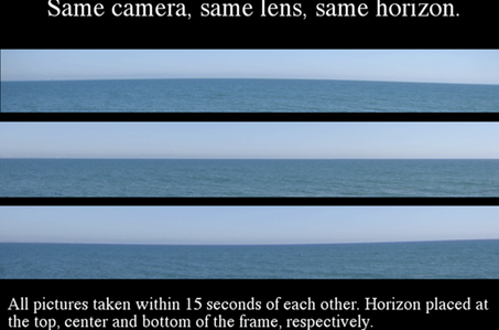
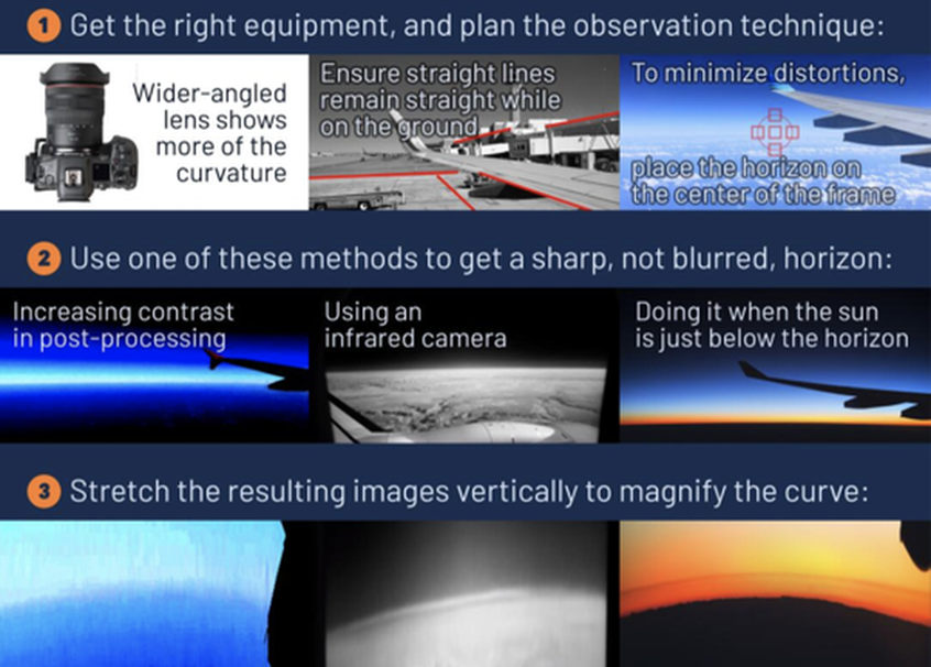
Visual daytime observations show that the minimum altitude at which curvature of the horizon can be detected is at or slightly below 35,000 ft, providing that the field of view is wide (60°) and nearly cloud free. Photographs purporting to show the curvature of the Earth are always suspect because virtually all camera lenses project an image that suffers from barrel distortion. To accurately assess curvature from a photograph, the horizon must be placed precisely in the center of the image, i.e., on the optical axis.
Interviews with pilots and high-elevation travelers revealed that few if any could detect curvature below about 50; 000 ft. High-altitude physicist and experienced sky observer David Gutierrez reported that as his B-57 ascends, the curvature of the horizon does not become readily sensible until about 50,000 ft and that at 60,000 ft the curvature is obvious. Having talked to many other high fliers (SR-71, U2, etc.), Gutierrez confirms that his sense of the curvature is the same as theirs.
Passengers on the Concorde(60,000 ft) routinely marveled at the curvature of the Earth. Gutierrez believes that if the field of view (FOV) is wide enough, it might be possible to detect curvature from lower altitudes. He has also talked to many commercial pilots, and they report that from elevations around 35,000 ft, they cannot see the curvature. Interestingly, since the demise of Concorde in 2000 resulting from a crash, the flat earth movement has grown considerably because currently no accessible commercial airline flies high enough to clearly see the earth's curvature.
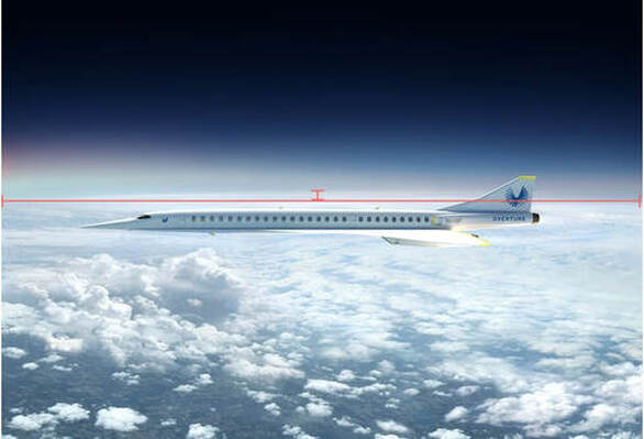
Boom Airplanes - The NEXT Concorde is coming soon and it will be D-Day is for Flat Earthers!!!
High altitude supersonic jets are going to be available soon for the public. Even United Airlines has recently purchased 15 Boom high altitude supersonic airplanes. At 60,000 feet the curvature CAN be seen!!!
Interviews with pilots and high-elevation travelers revealed that few if any could detect curvature below about 50; 000 ft. High-altitude physicist and experienced sky observer David Gutierrez reported that as his B-57 ascends, the curvature of the horizon does not become readily sensible until about 50,000 ft and that at 60,000 ft the curvature is obvious. Having talked to many other high fliers (SR-71, U2, etc.), Gutierrez confirms that his sense of the curvature is the same as theirs.
Passengers on the Concorde(60,000 ft) routinely marveled at the curvature of the Earth. Gutierrez believes that if the field of view (FOV) is wide enough, it might be possible to detect curvature from lower altitudes. He has also talked to many commercial pilots, and they report that from elevations around 35,000 ft, they cannot see the curvature. Interestingly, since the demise of Concorde in 2000 resulting from a crash, the flat earth movement has grown considerably because currently no accessible commercial airline flies high enough to clearly see the earth's curvature.
Boom Airplanes - The NEXT Concorde is coming soon and it will be D-Day is for Flat Earthers!!!
High altitude supersonic jets are going to be available soon for the public. Even United Airlines has recently purchased 15 Boom high altitude supersonic airplanes. At 60,000 feet the curvature CAN be seen!!!
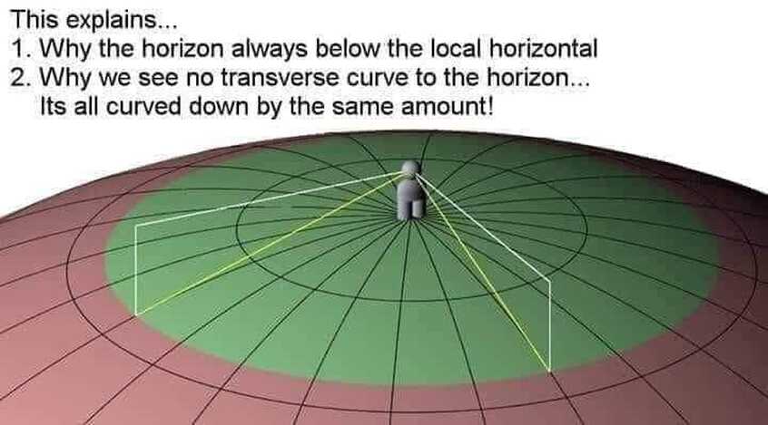
Problems in seeing the Earths Curvature (it is much harder then you think).
When trying to understand the perception of a curved horizon, two issues must be kept in mind.
Barrel distortion above and below center frameI
First, a large fraction of people wear eye glasses.
Eye glasses produce a variety of distortions when the observer is not looking through the center part
of the lens. Second, above the altitude of Mt. Everest, no observer can look directly at the horizon—he must look through a window or canopy. Plane parallel windows like those on most aircraft will not render a flat horizon curved, but a curved window
or canopy will.
Care must be taken to place the perceived horizon precisely at the center of the frame or there with be distortions!
So this is one thing that flat earthers do get right. Photographs purporting to show the curvature of the Earth are always suspect because virtually all camera lenses project an image that suffers from barrel distortion. But THIS ERROR GOES BOTH WAYS AS THIS IMAGE above depicts, so you can ALSO make the earth appear flat or even hyperbolic from faulty photography. Flat earthers love to cherry pick images that give distortions resulting in flat earth but will throw away inverted curvature renderings, because no one believes the earth is curved up. Watch the video below to TRULY see how cameras and photos can be deceiving (again applies to both sides).
Great research paper that goes over all this (link below):
http://thulescientific.com/Lynch%20Curvature%202008.pdf
Misleading Flat Earth High Altitude
Jason Kirby Blue Origin - https://youtu.be/OSWDX_JilvM
The blue origin footage has been proven to be false. Walter Bislin did an in depth analysis of that and proves very conclusively that it is not accurate. When you correct properly for lens distortion, the curve is there as exactly as modeled and expected.
http://walter.bislins.ch/bloge/index.asp?page=Blue%20Origin%20Flat%20Earth%20Video%20Analysis&fbclid=IwAR0SRelDtaGnO2oitkLTyMI1333vmkZ6UamHdwX1Zh84kD5Avg-D52J9oyc
Famous Flat Earth Image comes from THIS video.
Watch it all the way through and you'll see the earth is a curved when horizon is properly centered on horizon:
https://youtu.be/9dfVtaZbuIQ?t=10629
Watch it all the way through and you'll see the earth is a curved when horizon is properly centered on horizon:
https://youtu.be/9dfVtaZbuIQ?t=10629

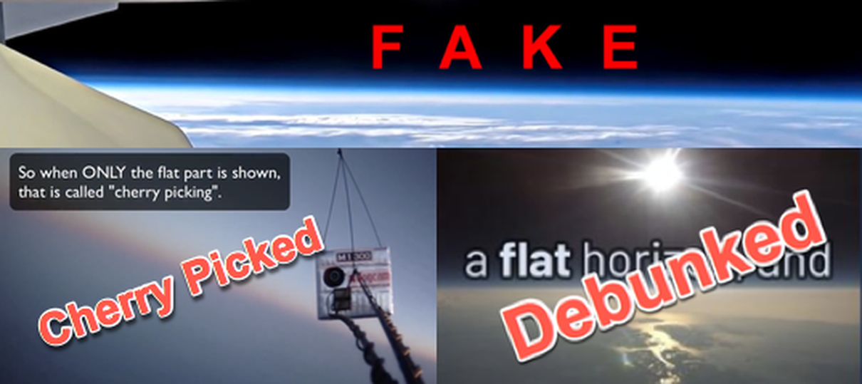
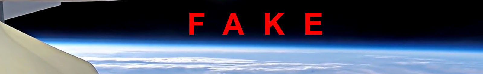
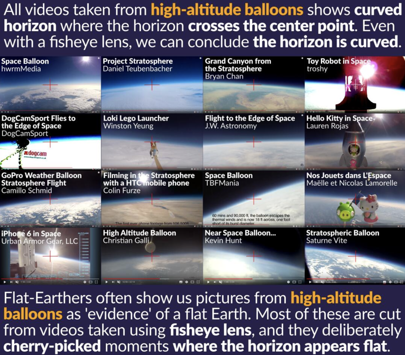
DogCamSport flies to the edge of space 110,000ft on a balloon!
https://youtu.be/WwimocU0IIc
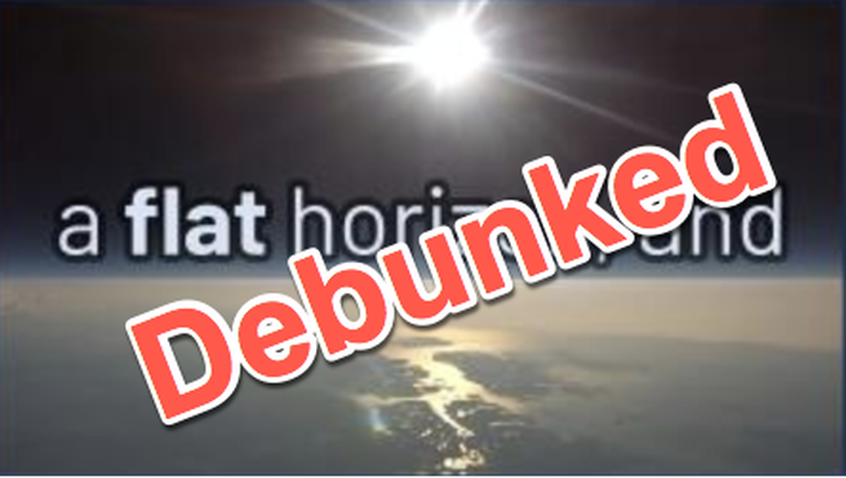
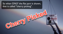
Photos from this video were cherry picked by flat earthers to show a flat horizon when in fact a curved horizon was actually there.
https://youtu.be/WwimocU0IIc
Photos from this video were cherry picked by flat earthers to show a flat horizon when in fact a curved horizon was actually there.
Real High Altitude
Barrel distortion above and below center frame
https://mctoon.net/dwaynekellum/
Barrel distortion above and below center frame
https://mctoon.net/dwaynekellum/
M-A-G-E 1 & 2
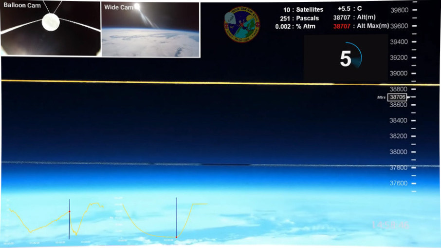
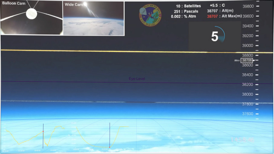
Mr Sensible conducted a high altitude ballon experiment that contained 3 cameras, a pressure and a temperature sensor and a GPS device. The goal was to record pressure, temperature and altitude, as well as to show the curvature of the earth to an altitude up to 39,000 m. The altitude was almost reached.
The Front Camera with the 2 strings in the field of view was a Firefly 8SE 90°, set to a diagonal field of view of 51.6°, see Measuring the Field of View of the Front Camera. This camera has only a slight barrel distortion, which Walter Bislin corrected with a Lightroom setting of 8 of 100, so that the 2 strings are straight and the image below shows the undistorted reality.
No Fisheye, slight barrel distortion EASILY corrected (As walter has done)
Field of View Narrow (curve would be more obvious in a larger field of view
Not only is horizon curved as expected on the globe but it drops from eye level 6.3 percent
MAGE 2 on youtube and MAGE 3 coming soon
Then Walter imported the image into his Curvature App, set the observer altitude to 38,706 m as indicated in the video and set the field of view to 51.6° as measured from the camera.
http://walter.bislins.ch/bloge/index.asp?page=M%2EA%2EG%2EE%2E+%2D+Mission+Above+Globe+Earth%2C+Image+Analysis
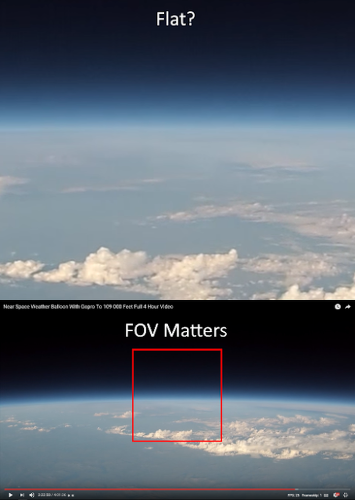
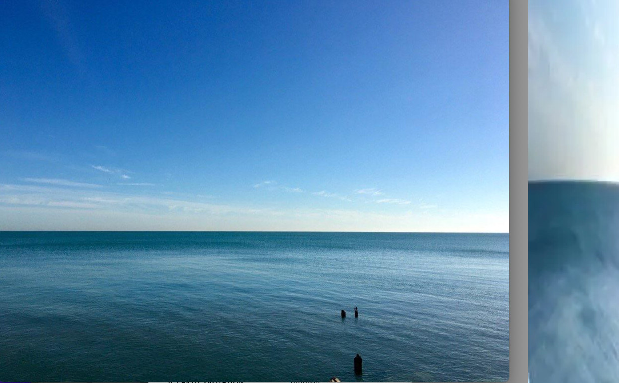
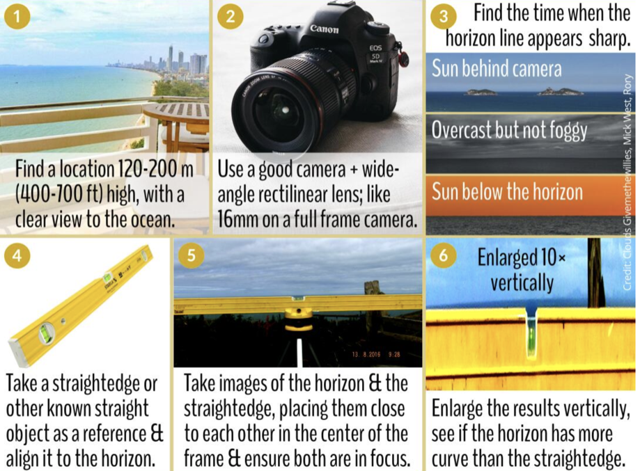
If you take great care to photograph the horizon right through the center of your lens with your camera very carefully leveled and at high resolution with a very high quality rectilinear lens you can actually view the slight curve of the horizon from much lower altitudes (even just a few hundred meters).
From just 200 meters elevation, on a 4000 pixel wide image at 94.4 degree field of view you should expect about 7 vertical pixels of rise out of the horizon circle (as shown in my calculator link).
You can make this slight ‘bump’ more visible by compressing the width of the image to about 10% of the original width and stretching it vertically by a factor of 2–4x.
For example, if we do this to the image here (which also required slight rotation):
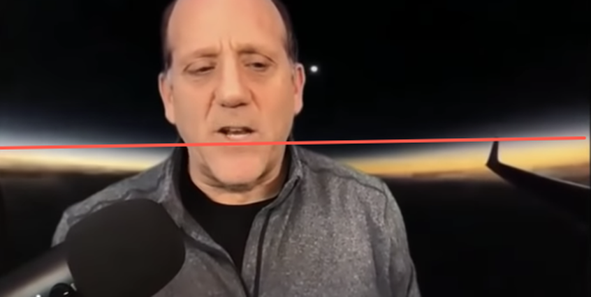
Seeing the Curve from a Commercial Flight
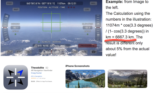
Calculating the Radius of the Earth with a Theodolite
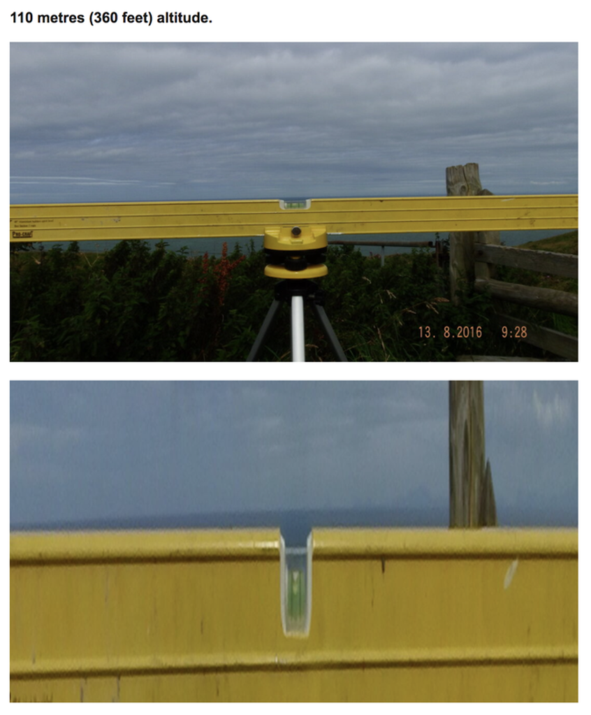
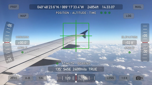
You can download the Theodolite app on your iPhone which uses the accelerometers to position a reticle in the camera view marking out level & plumb and has indicators showing the angle of the camera in relationship to level. If you are at high altitude like an airplane this will help to make the results more accurate. You can calculate the radius of the earth with some decent accuracy doing this.
Also notice from these images, you DO have to look down to see the horizon -- exactly as much as expected on a Globe of 3959 miles radius and we can observe the Dip angle increasing exactly as expected:
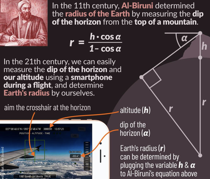
Al-Biruni was one of the great medieval scholars, well versed in physics, mathematics, astronomy, and natural sciences. He spent a large part of his life in Afghanistan. He is regarded as the father of geodesy for his important contributions to that field.
Abu Rayhan al-Biruni accurately determined the Earth radius by formulating a trigonometric equation relating the dip angle (between the true horizon and astronomical horizon) observed from the top of a mountain to the height of that mountain.
Abu Rayhan al-Biruni accurately determined the Earth radius by formulating a trigonometric equation relating the dip angle (between the true horizon and astronomical horizon) observed from the top of a mountain to the height of that mountain.
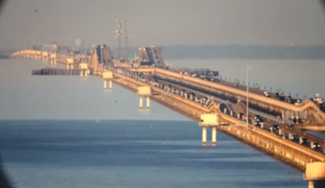
Here you can see the obvious earth curvature in this picture from the Lake Pontchartrain Causeway?