Geodesist - Gee -odd - uh - sist
Using a wide variety of tools, both on the land and in space, geodesists are experts at measuring things. Here are a few examples of what geodesists can measure.
With the precision of atomic clocks and lasers, geodesists can measure the pull of gravity so accurately, they could detect changes of one billionth of your body weight.
With tools that monitor the noise from outside our own galaxy, geodesists are able to measure the distances between two points on Earth to less than a millimeter.
By bouncing signals from satellites located hundreds of kilometers above the ocean, geodesists are able to track the rise of the mean ocean surface to about 1.7 millimeters per year.
And, probably most well-known, by using signals generated by GPS satellites that are located approximately 20,000 kilometers above the Earth, geodesists are able to accurately determine the positions of points to a few centimeters in just a matter of minutes.
https://flatearthdeception.com/geodesy-proof-of-the-flat-earth-deception/
Thanks to Walter Bislin for Below
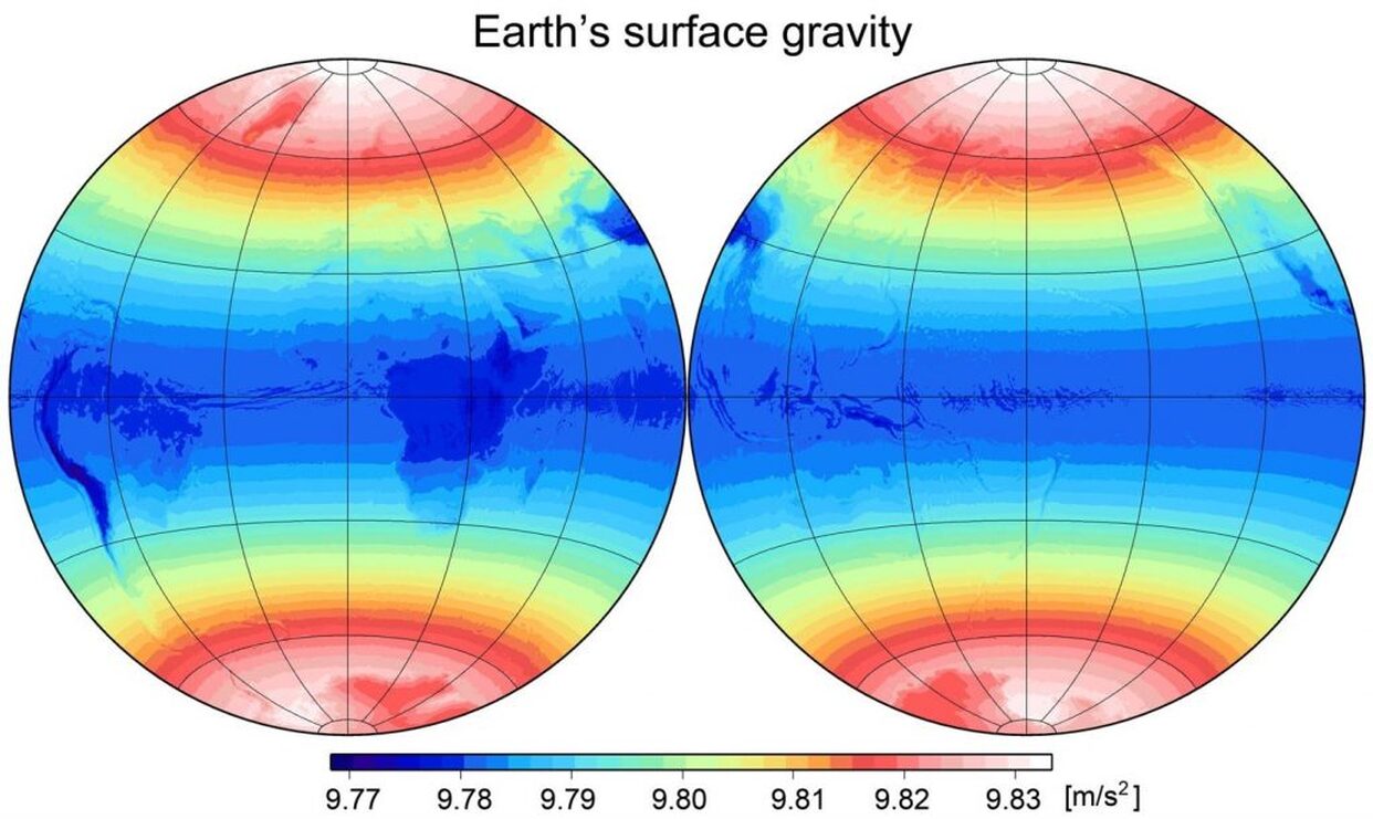
To give some scale (values in m/s²):
9.806 650 00 <- mean g
0.030 000 00 <- variation due to latitude
0.000 500 00 <- geoid variation
0.000 001 00 <- tidal influence of moon
0.000 000 50 <- tidal influence of sun
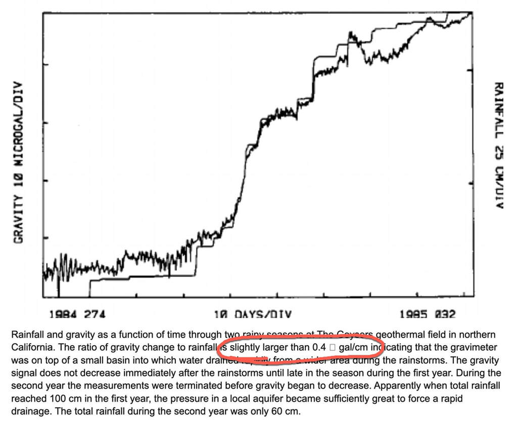
0.000 000 10 <- change due to 25cm rain
Using a wide variety of tools, both on the land and in space, geodesists are experts at measuring things. Here are a few examples of what geodesists can measure.
With the precision of atomic clocks and lasers, geodesists can measure the pull of gravity so accurately, they could detect changes of one billionth of your body weight.
With tools that monitor the noise from outside our own galaxy, geodesists are able to measure the distances between two points on Earth to less than a millimeter.
By bouncing signals from satellites located hundreds of kilometers above the ocean, geodesists are able to track the rise of the mean ocean surface to about 1.7 millimeters per year.
And, probably most well-known, by using signals generated by GPS satellites that are located approximately 20,000 kilometers above the Earth, geodesists are able to accurately determine the positions of points to a few centimeters in just a matter of minutes.
https://flatearthdeception.com/geodesy-proof-of-the-flat-earth-deception/
Thanks to Walter Bislin for Below
To give some scale (values in m/s²):
9.806 650 00 <- mean g
0.030 000 00 <- variation due to latitude
0.000 500 00 <- geoid variation
0.000 001 00 <- tidal influence of moon
0.000 000 50 <- tidal influence of sun
0.000 000 10 <- change due to 25cm rain